Forwarded from Sustrans:
| |||||||||||||||
Sustrans Sheffield
Activities of the Sheffield Sustrans Ranger group.
Thursday, 26 May 2011
Fwd: FREE cycle app now available
Monsal Trail Tunnels are Open
The official opening of the Monsal Trail tunnels happened yesterday, creating a new cycle route between Bakewell and Chee Dale (links between Matlock and Buxton are also being built, but I'm not sure of the status of these)
Sheffield Sustrans Volunteers didn't get invited to the opening ceremony, but Sheffield Cyclists, including Volunteers, Slobs and Cyclesheffield people did get out for a ride-through in the evening:-
& Here's a vid from @ianloasby
Sheffield Sustrans Volunteers didn't get invited to the opening ceremony, but Sheffield Cyclists, including Volunteers, Slobs and Cyclesheffield people did get out for a ride-through in the evening:-
& Here's a vid from @ianloasby
Wednesday, 25 May 2011
Tuesday, 24 May 2011
Sustrans Ranger Rides
A future date for your diary - Sustrans NCN6 Sheffield to Manchester Trailblazing ride, 13th August, starts 10:00 Sheffield Station.
Friday, 20 May 2011
Thursday, 19 May 2011
Routes revision in Sheffield
We had a planning session in Sheffield recently to plan the rationalisation of the meandering, myriad of National Cycle Network routes in Sheffield.
We agreed that:
NCN 67 should go from Chesterfield to Leeds via Rotherham and Barnsley
NCN 6 should go from Nottingham to Manchester via Worksop, Sheffield and across the Peak District on a new route…
And NCN (three figure number - to be determined, perhaps 627?) will pick up the open and proposed sections which links up the centres of Doncaster – Rotherham – Sheffield – Hillsborough and Penistone.
The other NCN routes in Sheffield are interim routes which (in the fullness of time) will become reclassified as local routes and will be signed as “this way to (x)”.
Route 6 would cross the Peak District on a new route utilising the towpath of the Peak Forest Canal, the collapsed A road at Mam Tor, existing rural lanes, a section of the Pennine Bridleway, the Sett Valley Trail, the dam of Ladybower reservoir, an existing signed route through Sheffield…
So the new routes should look something like these diagrams-
Wednesday, 18 May 2011
Route Closure - Chesterfield Canal
Please see information from Chesterfield contact officer Gemma Gregory, Regarding the closures in Staveley.
Chesterfield Canal (GENERAL) - There are unfortunately two TPT closures on the Chesterfield Canal towpath / TPT in the coming period (Spring/Summer 2011). Derbyshire County Council would like to apologise for any inconvenience caused, but all of the closures will bring significant investment and improvement to the Canal and the TPT in the short to medium term. Please use the diversion routes signed on the ground and if you experience any problems with signing or notices then please ring Tapton Lock Visitor Centre on 01246 551035. Updated 18th May 2011
Chesterfield Canal, Staveley - There is a 300m section of the TPT / Canal towpath to the north of Hall Lane in Staveley which is currently closed to all users. This is a temporary situation due to the ongoing works to create a new canal basin for the Chesterfield Canal on this site. The work commenced on 21st February 2011, and is planned to last for 34 weeks. The Trail is closed and diverted during the canal basin works and an alternative route through the centre of Staveley will be advertised and signed on site. A new, fully re-surfaced section of Trail should be created as part of the canal basin works and will be made available to all users as soon as practically possible (hopefully well before the end of the 34-week build). Updated 18th May 2011
Just to the south of Hall Lane, there is another 300m section of closure. This is a temporary situation during works by the Chesterfield Canal Trust Work Party Volunteers to create new wash walls as part of the restoration of the canal in this location. A new, fully re-surfaced section of Trail should be created as part of the canal restoration works and will be made available to all users as soon as practically possible. Updated 18th May 2011
Monday, 16 May 2011
Quick Spin on the Network
Had a quick ridearound on Sunday & this is what I found:-
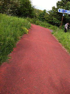
Meadowhall access to Chapeltown Greenway - it looks good but there is glass around, beware!
General condition of the Parts of the Network I looked at-
5 Weirs Walk -Good (Cobweb Bridge looks open for good.)
Chapeltown Greenway - Good.
Hillsborough - City Link - Good
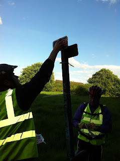
I also applied some destination stickers at Blonk St, Rutland Rd & Livesey St & had a very pleasant ridearound!
Gave this info board a spruce-up with Graffiti wipes. There are still remnants of Graffiti but at least you can read it!
We warned the council 2 or 3 years ago that if they didn't remove the budleia along here it would start to break up the brickwork and threaten the integrity of the river bank. Well, it's happened!
Meadowhall access to Chapeltown Greenway - it looks good but there is glass around, beware!
General condition of the Parts of the Network I looked at-
5 Weirs Walk -Good (Cobweb Bridge looks open for good.)
Chapeltown Greenway - Good.
Hillsborough - City Link - Good
I also applied some destination stickers at Blonk St, Rutland Rd & Livesey St & had a very pleasant ridearound!
Saturday, 14 May 2011
Sustrans Ranger Ride, 24th May
A quick heads-up that there will be a Ranger Ride on 24th May - over to Rother Valley & back to show Judith & Ian, our new rangers, around the route. Returning via the "Round the Airport" route. We'll take a few temp signs in case we see anything obvious that needs re-signing, but it's not a signing or maintenance ride as such. Meet 5:30 at Barkers Pool (City Hall) or elsewhere by arrangement.
Subscribe to:
Comments (Atom)


