Sustrans Sheffield

Activities of the Sheffield Sustrans Ranger group.

Monday 19 December 2011

TPT Improvements in Sheffield


Tenders are due in this week for next stage of Blackburn Valley Route – Chapeltown Greenway (Grange Lane to Cowley Hill).  The works should be complete by June. The council will then look to complete next section  - from Cowley Hill to Thorncliffe Road - towards end of next financial year.

After much complaint about the state of this section, a bound surface (tarmac) will be installed on 1km of Tongue Gutter at Parsons Cross in New Year, which will be a welcome improvement to the area.  It is hoped further surfacing will come on board as / when funding is identified.

Monday 12 December 2011

Workday on 10th December

Tim Hess, Volunteer co-ordinator for Sheffield North, writes: 


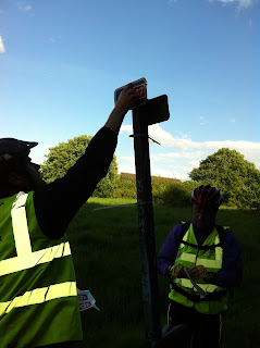
It was a chilly day for Tim Allen and me. Having stopped at a timber merchants in the morning we headed off to Greno Woods with two woodern 3 x 2 posts and some vinyl signs. The locations we had spied in the early autumn that needed signage were easy to spot and nature had cleared the vegetation for us.


We noticed again that the gates into Greno Woods from Wharnclifffe Side were left open and it will be only a matter of time before a car will end up being dumped somewhere in the woods. We will have to chase Street Force again and also the Wildlife Trust about this matter.


On route and just before a lunch of hot soup and a cup of cocoa we headed to Parsons Cross and installed as many signs as possible to cover up the inadequate work at the Asda and Penistone road junction. There is still a need to go up and install a lot more temporary signs on the entire route cover up for the lack of attention to detail from recent work – unfortunately we ran out of sign stickers.

After our signage work and digging we then headed off for a ride through Wharncliffe Woods to help produce a Treasure Hunt for school children on the Wortley to Grenoside Section. The work at Plank Gate looks pretty much complete. We realised that there is not many me memorable features of this route other than stunning woodland and mountain views. It took some creativity to come up with ideas for the treasure hunt.
It looks like there will be a need for new signs in the area to supplement the lovely wood carved markers that mark out the route when there is a number change. However, I think after our day’s signing work the signage should be up to standard in this area. Perhaps it needs someone to try to navigate this section and give an independent view.

Monday 5 December 2011

Connect 2 Killamarsh Progress

The contractor has made good progress on the embankments and bridge foundations & abutments over the last
month, but of course now we are heading into the bad weather.

The river bridge lift is now scheduled for Sunday 15th January.  At the moment, it looks like it will be around 7am in the morning (following the overnight rail bridge lift). 


Sustrans are going to issue a press release about the River Rother bridge lift and there could be a bike ride, or even a chartered tram for cyclists, to watch the event. 

SCC is looking to advance some of planned 'Phase2' works into this financial year, although we're still waiting on cost to know for certain. The first part of these works would be vegetation - small tree branches, shrubs, brambles - clearance along the corridor of the Phase2 route and there could be scope for a team of Rangers/ volunteers to help with the clearance work (or a defined section of the clearance work) in mid-late January.


Sunday 4 December 2011

Problems in Parsons Cross

Problem 1

Dumped cable on side of trail needs removal

SK 3790 9320

Problem 2

Trail heading toward Shire Green and Ecclesfield, trail too narrow and poor poorly surfaced. Not of suitable standard for cycle trail recommend cycle dismount signs until surfaces is upgraded

SK 3670 9372

Problem 3

Trail joining Hartley Brook Avenue need a permanent sign. All stickers get removed too quickly in this area. Gates is permanently open and will encourage cars / motorbikes

SK 3629 9268

Problem 4

Need a permanent sign at junction of Hartley Brook Rd and Molineaux Rd, no directions available

SK 3636 9262


Problem 5

Need a permanent sign at junction of Hartley Brook Rd and Barnsley Rd , no directions available

SK 3614 9251

Problem 6

Route in green space parallel to Deerlands Avenue too narrow unsuitable for cyclists. Diversions have been put up by Simon Geller. This route needs completely resurfacing before it is appropriate for cyclists.

SK 3540 9247

Problem 7

Roadworks on A61, no temporary signs to direct cyclists

SK 3386 9275

Problem 8

Gate left open to vehicles – is this part of works within Greeno Woods?

SK 3320 9435

Problem 9

Again gate left open to vehicles – is this part of works within Greeno Woods?

SK 3325 9554

Problem 10

Found a signage issue on Bridge Inn Rd. Not sure where quite from my notes.

SK 3504 9685

Thanks to Jon Fyne and Tim Allen


Monday 28 November 2011

Agenda for meeting 3rd December

Sustrans Ranger Meeting 3rd December


10 a.m. 285 Glossop Rd, Sheffield S10 2HB.(No bikes in building. Cycle parking at rear of building - fully secure parking available on request. )


1) Introductions (Dave Stevens)


 2) New roles (Mandy Loach)


Review of new roles and give you an opportunity to select which role suits you best:


Signing champion


Publicity


Media


Workday Organiser


Community Payback Scheme co-ordinator


Ride and Walk Leader


Fundraising Volunteer


Biodiversity


Route Maintenance Section Lead.


Route maintenance ad hoc


 3) New Route numbering.Action plan for re-numbering  (Dave Stevens)


Need to set a date and agree a method to sign the TPT signs or and leading  to the trail. This needs to be coordinated and coincide with a change on the Web.


4) Route allocation.  - Leaders/Rangers (Simon)


We will look at a the sections of the trail, the geographical spread of our group and divide the sections of the trail up by available Route Section Leads


13:00 Lunch (provided )


13:30 Ride - New route up to Ringinglow  (Route to the Peak Park)


16:00 Pub Sheffield Tap (Next to train station)

Friday 18 November 2011

Network News


  • Metal Theft is occurring on the Five Weirs Walk - if you see evidence of this please contact the police on 101 and Street Force - streetforce@sheffield.gov.uk, 0114 2734567. If you see it happening try to get a photo of the people involved but don't put yourself in danger. If there's a vehicle parked nearby that might be in use by the thieves try to get the registration number. 
  • Wharncliffe Woods - Forestry Commission says "We are harvesting adjacent to the Plank Gate - felling and extraction to roadside should be finished by next week - it will then just be a matter of how long it takes the merchant to haul the timber out of the wood.  At the latest, the contract must be finished by 31 December."
Otherwise, apart from on-going issues in Ecclesfield and Parson Cross (diversions are posted) the Network in Sheffield is clear for use. 

Tuesday 25 October 2011

Ecclesfield to Grenoside

Self & Andy Wild from SCC checked out a potential alternative route from the TPT at Ecclesfield to Grenoside.(there are problems with the current route)  - basically the route he uses to cycle up to see his mum!

 This is the railway path up to Chapeltown - due for upgrading to the Chapeltown Greenway
 This is the railway path up to Chapeltown - due for upgrading to the Chapeltown Greenway
 Due to lack of thought in design, this cycle track ends rather abruptly! 
A link is needed here to carry the route across the main road and into the back roads. 

It looks like a viable route with a bit of tweaking. 


Staveley Trails Open Again.

The Trans Pennine Trail through Staveley, whilst not complete, is open again. A new marina is in the process of being built:

 This is currently the limit of Navigation for the Chesterfield Canal west of the M1. If you wanted to
take your boat to Worksop you would have to lug it over the hill (See Werner Herzog:-)


 Although the surface is not complete people were already enjoying the ride,
 Here we are approaching the new marina.
 The trail goes underneath the new road
 Get your priorities right! Cycle Parking already in place
 This is the site of the new Marina
 I wonder if they will twig that this is the way people want to go?
 Heading E towards Arkwright Town - new road crossing. 
 People joining the trail from Polsbrook Country Park
 The end of the trail - landfill site beyond here. You can pop out on the road before this and head down to the Arkwright, a popular CAMRA pub with good food,
The trail could potentially continue across here and link to the Nutbrook Trail, taking you further south towards Mansfield and Nottingham.
Building a lock, 21st Century style. 

Sunday 23 October 2011

Derby Ranger meeting

Had a great day out with the East Midlands Ranger group yesterday. We pedalled up the superb Mickleburgh Greenway, which is very well supported and looked after by people, had some great (& cheap!) food in a Camper Van sales place, and some good beer in the Flower Pot. Derby has benefitted from Cycling City status and has some excellent off-road cycle-routes, which is just as well because the road system is highly cycle-unfriendly. The group turned out to be jsut as keen to talk about campaigning issues as trail maintenance, and we had interesting discussions about 20mph, Free Range Kids and Cyclenation.

The day was only slightly marred by a 1.5hr wait at Langley Mill for a train (don't ask what I was doing there!)

Monday 5 September 2011

Bowden Housteads Link

A short piece of track between the A57 Mosbrough Parkway junction and the bridge over the Parkway leading to Bowden Housteads wood has been officially designated a cycleway. That will enable us to sign it as a link between NCN6 & 67,   avoiding a steep climb up to the next bridge followed by a downhill again & this will be incorporated in the re-signing exercise we're working on (see earlier posts) . 

Wednesday 24 August 2011

More cleaning up at Manor Way

Morris & myself had a successful morning cleaning up at our favourite place (no I didn't take any pictures, just look through the older blog posts if you want to know what it looks like.) I do feel we're getting to a point where we can say that the Victoria Quays - Rother Valley route is up to a reasonable standard most of the time. 

Sunday 14 August 2011

Sheffield to Manchester route


View Sheffield to Manchester in a larger map

Route description: http://www.cyclesheffield.org.uk/route-planning/long-distance-routes/sheffield-to-manchester/

Sustrans people rode the route on 13th August.

Highlights of the trip were:-
The gorgeous Porter Valley Route.
Dramatic views across Burbage & Bamford moors and courteous treatment by drivers.
Ladybower Dam & the Thornhill Trail
Pretty countryside around Slackhall.
The High Peak tramway
The Floop - a superb route, very well maintained. Good to see that that some of the dafter access controls have been removed (e.g. Sainsburys Fallowfield)
Access to City Centre from Fallowfield along Wilmslow Rd was reasonable.
A good pint at the Sand Box. 
Plenty of room on the Northern Rail stopping train via Hope Valley for bikes.


Agreed that Sheffield Bamford Station could be opened as an interim route and Bamford to New Mills is close to being interim. 


Things we spotted yesterday which would enable upgrade of status from “interim” to “fully open” 


Permission to use Guernsey Rd/Lynwood Gardens/Park Lane rather than Clarkehouse Rd
Slower speeds on Clarkehouse Rd
Removal of demarcation line in Bingham Park - making it fully Shared Use
Better crossiings at Hangingwater, Whiteley Wood Rd, “Quiet” Lane.
Slower speeds on Sheffield section of Ringinglow Rd
Allow cycling across Ladybower Dam.
Allow cycling on track between Aston & Hope Cemetery - Negotiate via Caravan Club.
Measures to reduce congestion in Castleton
Metalled cycleway on Mam Tor

Slower speeds on Rushup Edge

Widen pavement on A624 between (?name of lane) & Charley Lane.
Access issues on High Peak tramway - current status is unclear.
Improve crossing at Bugsworth basin. (signage for Pennine Cycleway needed here.)
Partial re-surfacing of canal towpath New Mills - Marple.
Completion of Connect 2 scheme at Marple.

Note that canal towpath surface beyond Marple is not suitable for interim route.

Link from roadway to Floop at Longford Rd West was not clearly signed.

Friday 22 July 2011

Disgruntled customer ride

Well , it's just the way it goes. You take a couple of disgruntled customers, who say they got lost on the way to Meadowhall, out for a ride and make them fix all the signs they say they missed. Then, when you get back to Sheffield Station and offer to buy them a drink (Celia had to go home and get dinner) who should you run into but a whole bunch of Sustrans Bike It officers who've been out to the Peak District for a team meeting. So naturally you make the last remaining Disgruntled Customer buy all the drinks. Hooray!

Tuesday 5 July 2011

Sustrans Voliday

Sheffield University staff from External Relations volunteered to help clean up the National Cycle Network on the 5th July 2011 and had a great time. Here's some pix from the day:-


If you'd like to get your team out on a workday on the National Cycle Network, get in touch - we can arrange it.

Thursday 26 May 2011

Fwd: FREE cycle app now available


Forwarded from Sustrans:

Sustrans logo Join Sustrans Join Us Donate Sustrans
Dear Simon

Finally, the National Cycle Network app

Download our FREE 'The complete National Cycle Network' iPhone app today and explore:


  • 25,000 miles of route (including all 13,000 miles of the Network)
  • great local detail (over 90,000 points of interest including shops, schools, bike shops, accommodation and attractions)
  • GPS tracking (record your route and share it with your friends, even if they don't have an iPhone)
  • every bus stop and train station in the country with links to their timetables
'The complete National Cycle Network'
A great 'go-to' app for getting around everyday - download it for FREE!

Monsal Trail Tunnels are Open

The official opening of the Monsal Trail tunnels happened yesterday, creating a new cycle route between Bakewell and Chee Dale (links between Matlock and Buxton are also being  built, but I'm not sure of the status of these)

Sheffield Sustrans Volunteers didn't get invited to the opening ceremony, but Sheffield Cyclists, including Volunteers, Slobs and Cyclesheffield people did get out for a ride-through in the evening:-


& Here's a vid from @ianloasby


Wednesday 25 May 2011

Sustrans Ranger Ride, 24th May

New recruit Ian Belton and recent recruit Tim Allen came on a ride to Rother Valley and did a bit of signing en route:-


Tuesday 24 May 2011

Sustrans Ranger Rides

A future date for your diary  - Sustrans NCN6 Sheffield to Manchester Trailblazing ride, 13th August, starts 10:00 Sheffield Station. 

Cobweb Bridge

The Cobweb Bridge has had temporary repairs and is open at the moment. However, it is going to receive an entire new deck so it will be closed again for a while when this is done. We'll leave the diversion signs in place until this is finished.


Thursday 19 May 2011

Routes revision in Sheffield


We had a planning session in Sheffield recently to plan the rationalisation of the meandering, myriad of National Cycle Network routes in Sheffield.

We agreed that:

NCN 67 should go from Chesterfield to Leeds via Rotherham and Barnsley

NCN 6 should go from Nottingham to Manchester via Worksop, Sheffield and across the Peak District on a new route…

And NCN (three figure number - to be determined, perhaps 627?) will pick up the open and proposed sections which links up the centres of Doncaster – Rotherham – Sheffield – Hillsborough and Penistone.

The other NCN routes in Sheffield are interim routes which (in the fullness of time) will become reclassified as local routes and will be signed as “this way to (x)”.

Route 6 would cross the Peak District on a new route utilising the towpath of the Peak Forest Canal, the collapsed A road at Mam Tor, existing rural lanes, a section of the Pennine Bridleway, the Sett Valley Trail, the dam of Ladybower reservoir, an existing signed route through Sheffield…

So the new routes should look something like these diagrams-